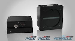
FEATURES
- Multiple camera capture.
- HD resolution up to 50 MP.
- Tag each image with GNSS metadata.
- Frame capture rate driven by travel distance using DMI device.
- Real Time JPEG compression.
- Supports over 200 different types of cameras and frame grabbers using native API’s.
- GigE Vision, USB3, 10 and 25 GigE, Camera Link, and CoaXpress.
IN-VEHICLE IMAGE CAPTURE
- G-Force resistant.
- Multiple camera setup.
- Fanless, with an operating temperature from -40 to +75 Celsius.
- Shock and vibration resistant.
- Up to 5 kg in weight.
APPLICATIONS
- Paved Surface Inspection.
- Roadside Feature Inventory.
- Roadway Asset Management.
- Power Transmission and Distribution.
- Pipelines inspection.
- Railways.
![Exo Svs Vistek Pipettenprüfung[1] Exo Svs Vistek Pipettenprüfung[1]](https://img.vision-systems.com/files/base/ebm/vsd/image/2023/05/EXO_SVS_Vistek_Pipettenpru__fung_1_.645d3640bd697.png?auto=format,compress&fit=crop&q=45&h=139&height=139&w=250&width=250)
